Experience the Magic of the Stirling Ranges
Experience the Magic of the Stirling Ranges
Posted on
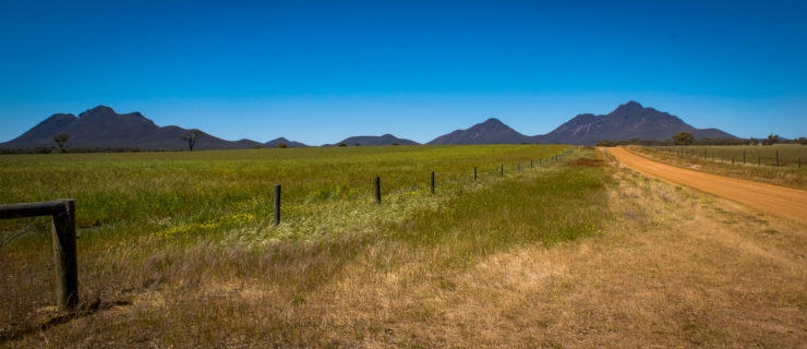
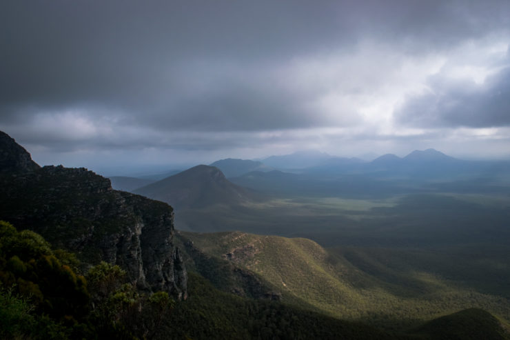
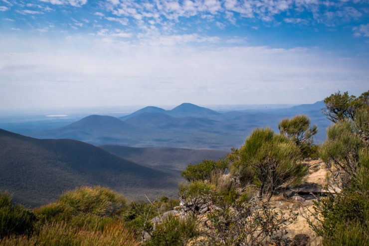
Deep down within most of us that pursue the ancient pastime of walking somewhere for no other reason than enjoyment is the desire to seek out greater heights to take stock of the landscapes that surround us. While Western Australia is not what you would call a mountainous area by any stretch of the imagination, we are lucky to have an ancient patch of granite slopes north of Albany that allows us to indulge in our hiking dreams.
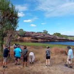
Within the small expanse of the Stirling Range, so named after an 1835 expedition by Governor James Stirling and John Septimus Roe, is a hilly playground full of wildlife and wildflowers. Before European settlement the area was inhabited by the Qaaniyan people (western parts) and the Koreng people (eastern parts) and the mountains played a vital part in their survival and Dreamtime stories. Thankfully it has been reserved as a national park since the early 1900s for everyone to enjoy and for the unique and diverse wildlife to exist somewhat peacefully.
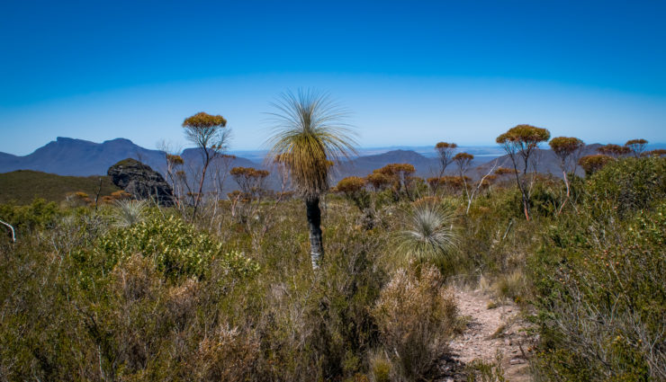
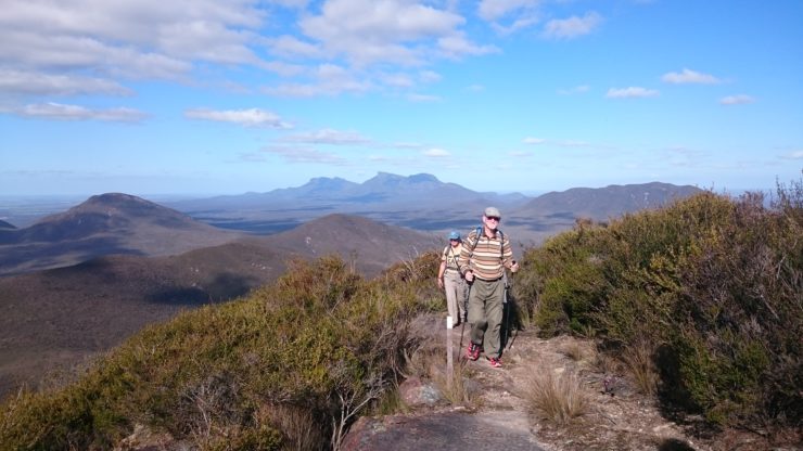
It’s not hard to fall in love with the place and I’ve yet to run into someone that doesn’t immediately have an outpouring of positive things to say about their latest trip to the area. For most people they can easily conjure a story or two from their childhood or a recent road trip to scale one of the peaks. Having such a diverse range of experiences from driving trails, short walks to lookouts, day hikes up to various summits and the infamous Stirling Ridge Walk means people of all ages and fitness levels can connect with the land in their own way.
Bluff Knoll
Length – 6km Return | Highest Point – 1098m | Time – 2-6 hours
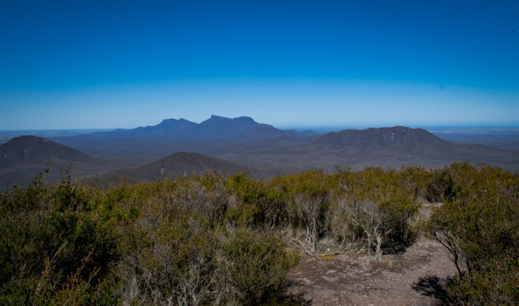
Being the highest point in the South West, Bluff Knoll naturally attracts a lot of tourists and given the quality of the path to the summit, that is well deserved. It’s something of a rite of passage for West Aussie’s and the reward for reaching the top on a clear day is breathtaking views of the surrounding area and a nice sense of accomplishment. A clear day is far from guaranteed though as the weather is notorious for changing without warning so be prepared with some wet weather gear. The misty conditions were said to be revered by the local aboriginal people as they named Bluff Knoll Pualaar Miial or “great many-faced hill”. The rolling mists provide some great photographic opportunities and the drive out to the car park from Chester Pass Rd frames Bluff Knoll perfectly.
Toolbrunup Peak
Length – 4km Return | Highest Point – 1052m | Time – 2-6 hours
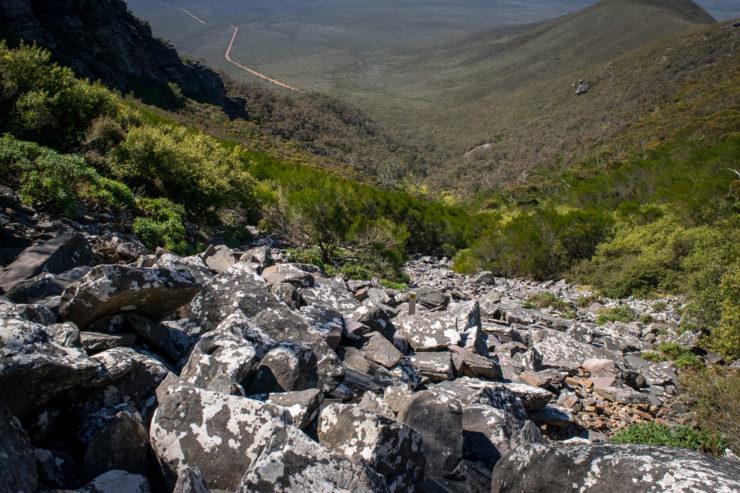
Bluff Knoll may be the most popular day hike in the Stirling Range but the toughest hike goes to Toolbrunup Peak located not too far away. This infamous peak attracts those looking for more of a challenge and the scramble up the well known scree fields provides a tough obstacle to anyone wanting to reach the top. While the trail is well marked, getting up it at times isn’t as easy with shifting boulders, steep ascents and slippery rocks but the views from the summit are well worth it. For an extra challenge get there before dawn and catch the sunrise from the summit.
Mt Trio
Length – 3km Return | Highest Point – 856m | Time – 2-4 hours
Whilst not one of the taller mountains in the area, Mt Trio makes up for this by being a no nonsense introduction to the Stirling Range. As soon as you have left the car park you are introduced to a steep exposed climb all the way to the easier saddle section of the trail. Being able to see the summit from step one doesn’t make this climb any easier but when you do reach the saddle you can catch your breath and enjoy the views to Bluff Knoll and across to Mount Hassell and Toolbrunup.
Mount Magog
Length – 7km Return | Highest Point – 856m | Time – 2-5 hours
One of the lesser known hikes in the Stirling Range, Mount Magog is certainly a bit wilder with an overgrown track and rock scrambling waiting for you near the summit. Don’t be fooled by the easy start, the going will get tough when you reach the base of the climb but for those willing to push on, this will be another unforgettable experience.
Mount Hassell
Length – 3km Return | Highest Point – 847m | Time – 2-4 hours
This hike is a tale of three peaks with the climb being separated into manageable stages each with a short flat section to rest up on. To help distract you from the burning calves, the views east towards Bluff Knoll and Mt Trio are astounding so you hardly notice the legs crying out for you to rest. Watch the car park turn into an insignificant dot below as your reach the final climb up to the summit where you will have to negotiate a slight scramble up a rock face before soaking in some of the better views in the Stirling Range. The imposing summit of Toolbrunup looms large but for now you have conquered another peak so take some memories and enjoy the peaceful surroundings.
Talyuberlup Peak
Length – 2.60km Return | Highest Point – 784m | Time 2-5 hours
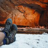
The shortest peak in the Stirling Range is by no means the least enjoyable with Talyuberlup Peak offering a steep climb, an impressive cave and some of the best views available. The steep climbing doesn’t take long to get to and from there it is an exposed hike until you reach the shadow of the peak. From there you skirt around the base of the summit and past the imposing cave (do not enter as it is unstable) to the hairy climb up steep rock faces to the summit. Spot the giant dragons nest marking the summit and marvel at Red Gum Pass to the west and the other peaks located to the east.
Stirling Ridge Walk
Length – 28km One Way | Highest Point – 1098m | Time – 2-4 days
Arguably one of the toughest multi-day hikes, the Stirling Ridge Walk is not for the faint of heart. With no marked trail for most of the hike, unreliable water along the way and the steep ascents and descents that will be your path for the entire duration, it is no wonder that the SAS use this area for training purposes. Changing weather conditions, false trails and strong alpine winds make this trail a great challenge for all those that attempt it. If you are thinking about taking on this feat then please do your research and carry the right equipment and supplies.
-Mark Pybus
Guest blogger
CLICK HERE to check out Inspiration Outdoors 5 Day walking tour of the Stirling Ranges