The Great Ocean Walk – Everything you need to know

The Great Ocean Walk – Everything you need to know
Posted on
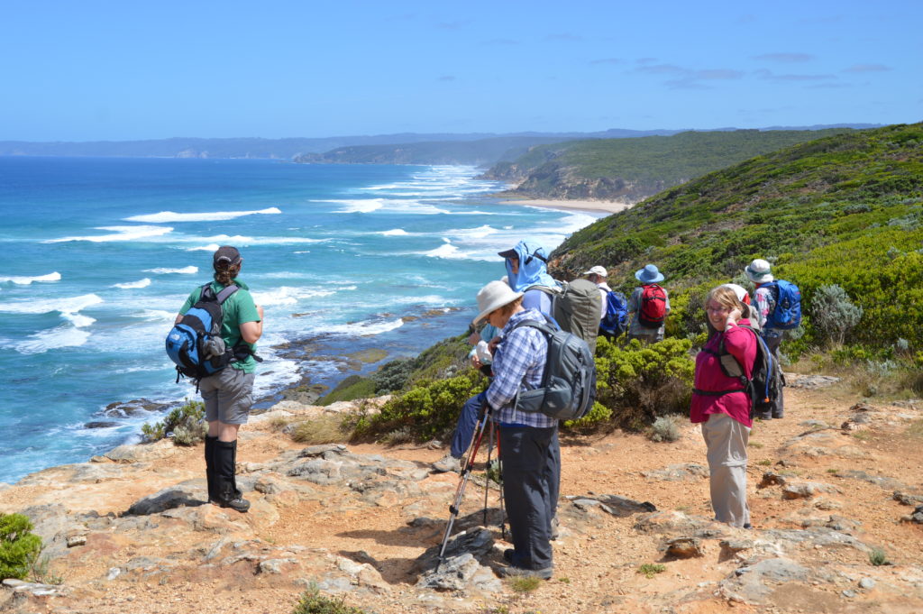
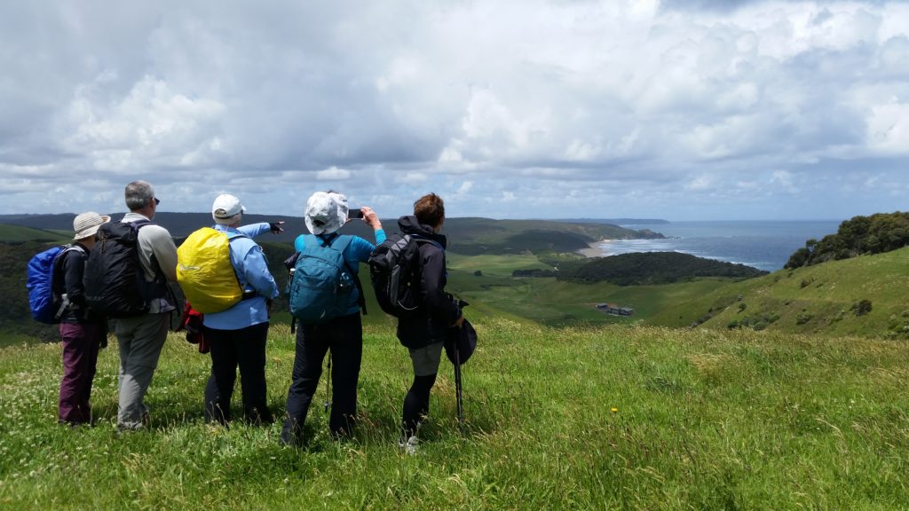
The Great Ocean Road is quickly becoming one of the most popular tourist attractions that Victoria has to offer (and for good reason). But for those more adventurous souls who like the idea of escaping the traffic and beating the crowds, the Great Ocean Walk offers an immersive experience through one of Australia’s most iconic and diverse stretches of coastline.
Where is the Great Ocean Walk?
Unfolding across 104km from Apollo Bay to the Twelve Apostles on Victoria’s South Coast, the Great Ocean Walk spans an area rich in environmental significance and cultural history. From the Gadabanud – the traditional owners – through vast waves of colonial exploration, logging, whaling, and mining, the area retains remnants of its tumultuous past but is now protected by the Great Otway National Park.
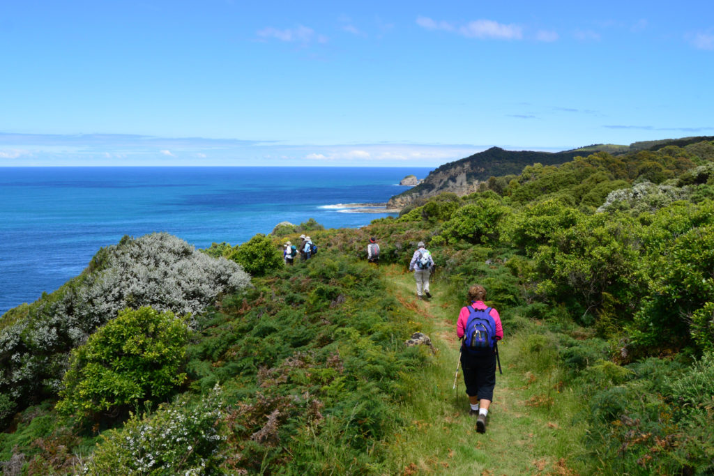
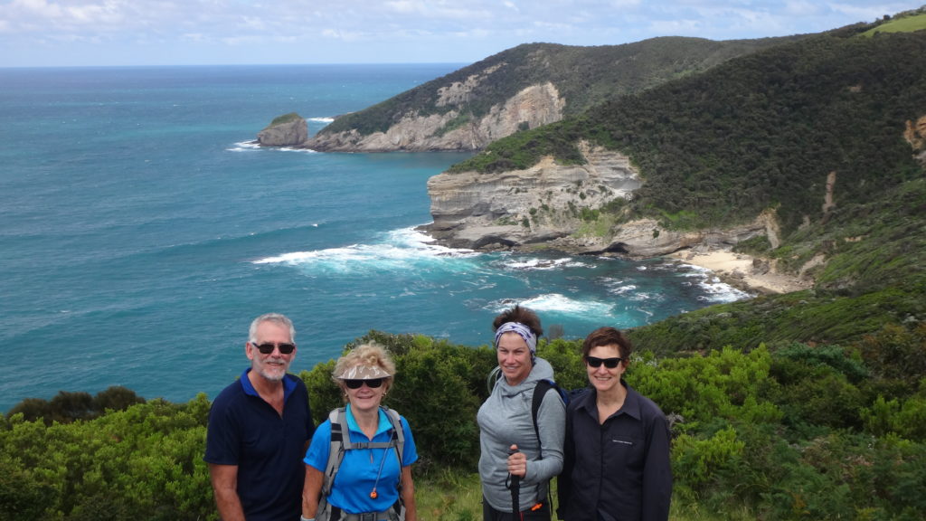
The walk predominantly follows the coastline – aptly known as ‘The Shipwreck Coast’ – making the most of the exceptional escarpment that has been dramatically shaped over geological ages by the wild Southern Ocean.
How Difficult is the Great Ocean Walk?
The walk ranges in difficulty from ‘Easy’ through to ‘Hard’ but a well-maintained track and good infrastructure make it doable for anyone with reasonable fitness and a bit of walking experience. The longest day stretches for 16km, and the more technical sections of coastline are all accompanied by ‘Decision Points’: alternative tracks inland if the sea conditions, tides, or weather aren’t working in your favour. Check out the breakdown of walking days from ‘Visit Victoria’ for more information.
However, if a 6-day walk carrying a tent and all your food sounds a bit daunting there are several road access points that allow a number of spectacular day or overnight trips instead. Visit Victoria offers some great information on alternative itineraries.
When is the Best Time to Walk the Great Ocean Walk?
The Great Ocean Walk is definitely a year-round venture, but hot temperatures in summer and blistering Southerly winds in Winter will definitely alter your experience. If you ask us, October offers perfect walking weather with more reliably clear skies, as well as the added bonus of spring flowers. Remember to always check the weather forecast on the days you plan to be walking.
How to Organise the Great Ocean Walk?
We offer two comprehensive packages for the Great Ocean Walk: the full walk over 7 days, or a highlights package in 4 days. Both include exceptional food and comfortable accommodation options. Take a look at our package options here.
But for those who want the thrill of the wild here’s an all-inclusive rundown with most of the information, you will need.
The walk runs in one direction – East to West – and small, unpowered campsites can be booked for a small fee through Parks Victoria.
All of the campsites have composting toilets and rainwater tanks. There is no charge to walk the track itself.
Transport to and from the ends of the walk can be tricky. PTV offer a public bus service along the Great Ocean Road that will get you to Apollo Bay and there is a variety of private shuffle services that cater specifically for walkers.
But probably the most reliable and efficient way to get yourself to and from is to leave your car at the Princetown Recreation Reserve for a small fee. The reserve is just over 5km before the Apostles and from here you can take advantage of one of the local shuffles to get you to and from the ends of the walk that many of the accommodations/tourist-centres offer.
The itinerary for the walk itself varies based on your individual fitness and speed, but here’s our recommendation for 8 days and 7 nights that make the most of this incredible walk.
Day 1: Apollo Bay – Elliot Ridge | 9.8km
The visitors centre at the seaside village of Apollo Bay is the official start of the Great Ocean Walk. From here, the trail follows the Great Ocean Road to the Marengo Reefs Marine Sanctuary. Spot a seal bathing in the sun on the exposed Little Henty Reef before veering away from the road and heading along Shelly Beach to the first night’s camp at Elliot Ridge.
Day 2: Elliot Ridge – Blanket Bay | 12km
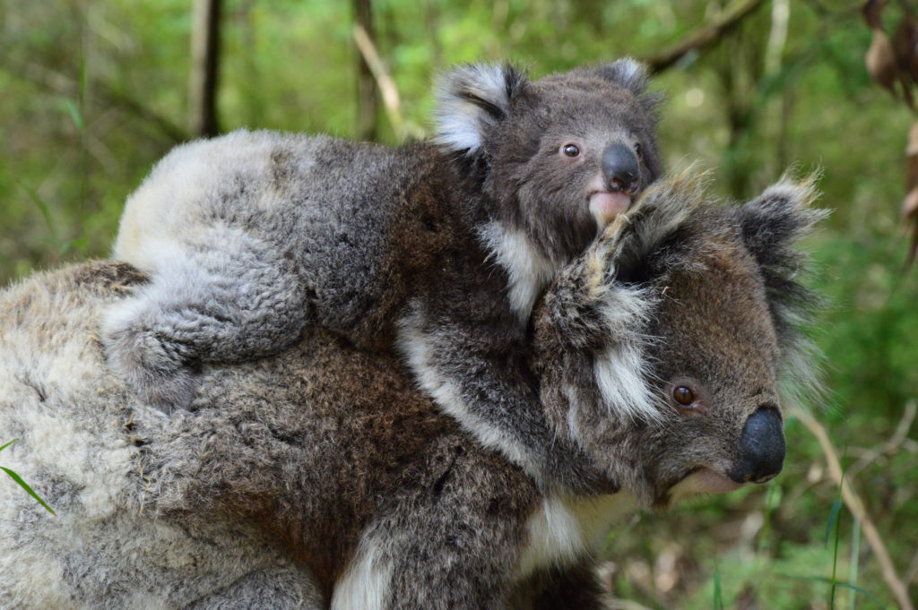
From Elliot Ridge the track heads inland, away from the coast but into some of the last remaining pockets of old growth Mountain Ash forest in Australia. Look high and spot koalas, an array of birdlife and look out at ground level for the elusive Otway Black Snail (if you’re lucky), a carnivorous land snail endemic to the Otway Ranges.

The track meets the coastline again at Blanket Bay where enjoy the afternoon, have a swim and relax in the grassy and very comfortable campground.
Day 3: Blanket Bay – Cape Otway | 10.5km
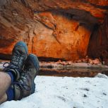
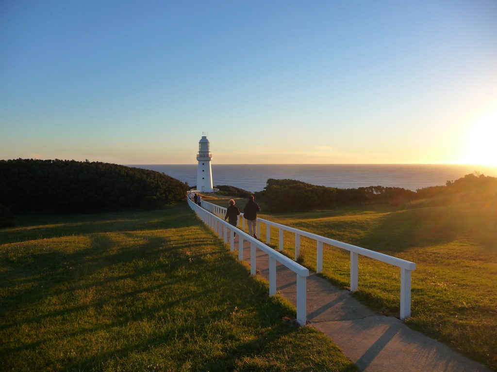
After a day inland, the track follows the coastline, undulating over coastal heath and forests of Messmate Gum. Walk through spectacular communities of Xanthorrhoea, descend into the magnificent Parker Inlet before reaching the iconic Cape Otway Lighthouse for sunset (and and a climb to the top if you arrive before 4.30!)
Day 4: Cape Otway – Aire River | 9.6km
A departure from Cape Otway enters straight into natural tunnels of Tea Tree and Coastal Acacia. The track meanders further along the coastline and offers tantalising glimpses back to the east before turning inland towards the Aire River Wildlife Sanctuary, a seasonal wetland with a wealth of biodiversity that the campsite borders.
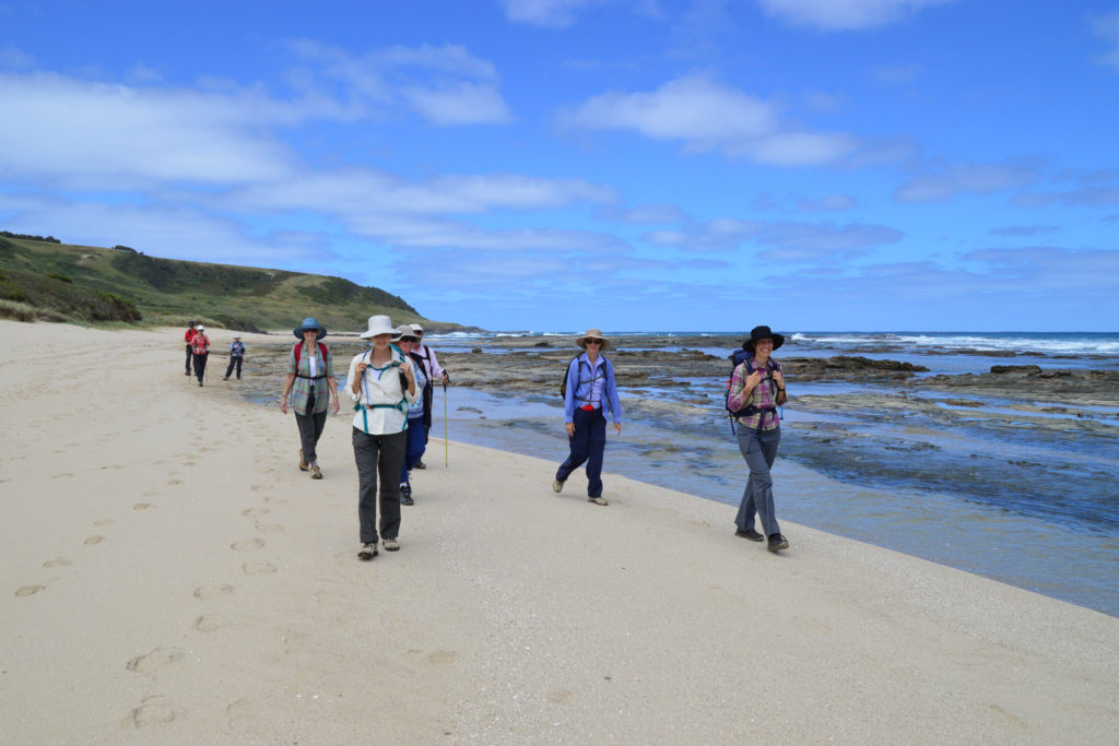
Day 5: Aire River – Johanna Beach | 13.8km
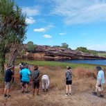
The sandstone formations that form the cliff line of this section of the walk will excite even the least enthusiastic of geologists. After Castle Cove and a brief rendezvous with the Great Ocean Road, the track passes Dinosaur Cove, one of the most exciting areas in Australia’s Palaeontological history and continues along the coast to Johanna Beach, an expansive and remote stretch of sand at the end of which lies your campsite for the night.
Day 6: Johanna Beach – Ryans Den | 13.8km
From Johanna Beach the track briefly heads inland again through a diverse environment of coastal heath and rolling hills of farmland before the descent into the spectacular Milanesia Beach. Look out for the small fisherman’s cottage, tucked in behind the dunes, resist the urge to stay here forever and start the climb up to Ryans Den.
Day 7: Ryans Den – Devils Kitchen | 12.8km
One of the more demanding days of the walk, the track from Ryans Den is well worth the effort. The imposing sea cliffs of Moonlight Head are some of the tallest in Australia at 130 metres. The track from here winds through wet sclerophyll forest, crossing over (bridged) creeks and finishes at Devils Kitchen. The campsite that sits high above the coastline and boasts what may be one of the best views you will ever witness from a loo.
Day 8: Devils Kitchen – 12 Apostles | 16km
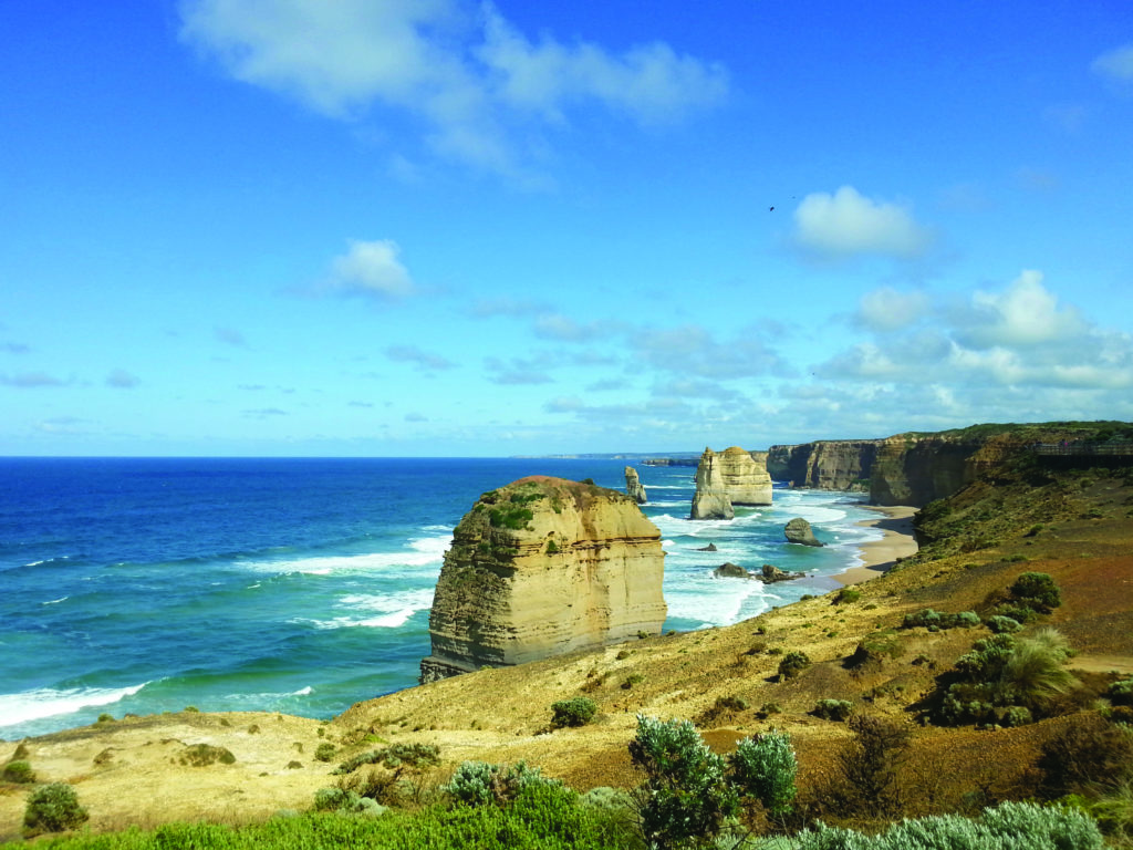
From Devils Kitchen, the track follows the escarpment to the Gellibrand River. After passing through the Princetown Recreation Reserve it’s the home stretch as the track makes its way through the back of the dunes and closer towards the cliff line with teasing glimpses of the Twelve Apostles. The Great Ocean Walk viewing platform stands high above the Southern Ocean and offers a different, and well-earned perspective of the Apostles. The track then passes Gibson steps and follows the Great Ocean Road to the Twelve Apostles Visitors Centre and the official end of the walk.
Things to Look Out For
Being a remote, multi-day walk, there are inherent dangers that can all be mitigated with proper planning and preparation. There is little phone reception along the track and we always recommend carrying a PLB or Satellite phone and filling out a ‘Trip Intentions Form’ with Victoria Police.
Other things to keep in mind:
The Sea:
The walk follows a dangerous coastline, the ‘Shipwreck Coast’ (the name is well earned) and as a result rogue waves, high tides, and swollen river mouths all present specific dangers. As mentioned, all the potentially dangerous river crossings and areas affected by tides have alternate routes so keep an eye for the ‘Decision Points’ and always plan ahead.
Weather:
Again, the unpredictable nature of coastal weather systems means storms, high winds, and rain can all approach quickly and without warning. Many sections of the track are exposed and offer little protection in such events. But again, the right gear and sufficient planning will keep you relatively safe.
Drinking Water:
There is no drinkable water along the track. The rainwater tanks at the campgrounds are not guaranteed to have water and are untreated so means of water treatment are essential.
There are a multitude of tablets, filters and UV lights that can accomplish this task for you. We plan to dedicate a separate article to water treatment and planning during long hikes.
Bushfires:
Being a national park, bushfires are an ever-present risk. Keep an eye on conditions and warning signs and be informed of any planned hazard reduction burns in the area. The FFM Victoria update their scheduled burns regularly.
If you’re doing the walk, have a look at the Parks Victoria FAQ Sheet for more information on these issues.