The Cape to Cape Track – Everything you need to know
Posted on
Updated: 21st January 2026
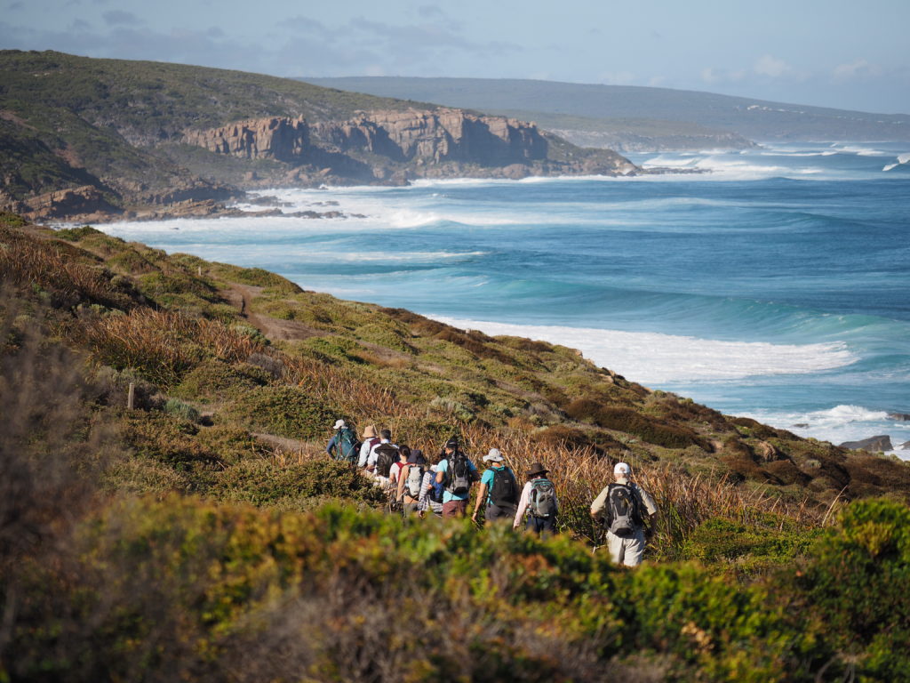
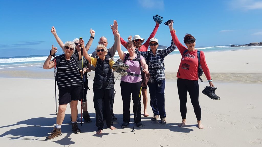
For many, walking the Cape to Cape Track is a rite of passage—a coastal pilgrimage that winds between two of WA’s most iconic lighthouses. Stretching across towering granite cliffs, white sand beaches, and towering karri forest, this is one of the most captivating multi-day hikes on the Australian coastline.
Whether you’re planning to tackle the whole thing or just a section or two, here’s everything you need to know to get the most from your Cape to Cape experience.
Where is the Cape to Cape Track?
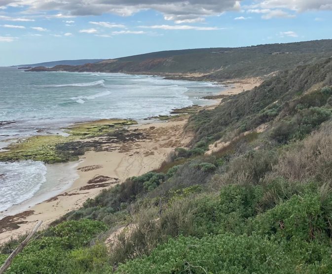
The Cape to Cape Track is located in the Margaret River Region of Western Australia. Starting at Cape Naturaliste Lighthouse near Dunsborough and finishing at the Cape Leeuwin Lighthouse near Augusta, the trail covers 123 km of diverse terrain and stunning views of the Indian Ocean.
The route takes you through varied landscapes—dramatic granite outcrops, pristine bushland, forested valleys, coastal heathlands, and long stretches of beach. You’ll pass through tranquil spots like Smiths Beach, Cowaramup Bay, Boranup Forest, Boranup Beach, Canal Rocks, and Redgate Beach, with the trail winding through both wild and well-known landmarks.
The Green trail on the map below shows the route of the trail.
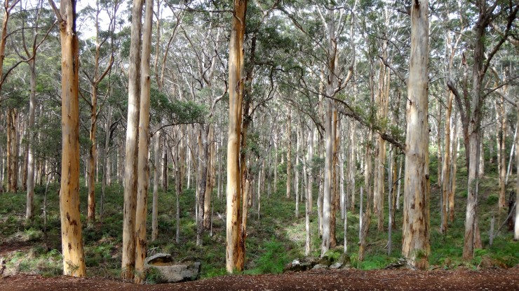
The track predominately runs along the coast, but also goes inland into Jarrah forests and Karri forest.
How can I walk the Cape to Cape track?
There are 4 options for walking the Cape to Cape track;
- Walk independently, carrying a hiking pack and sleeping in tents at the campgrounds.
- Walk with a guided tour group that will take you back to accommodation each night.
- Do “Day walks” of various sections of the trail
How hard is it to walk the Cape to Cape track?
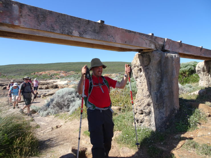
The terrain on the Cape to Cape Track is mostly moderate, making it ideal for fit walkers with a reasonable fitness level. While there aren’t many steep hills—especially when compared to places like Tasmania or Nepal—there are still notable challenges, particularly the long beach stretches (which can be especially tough when the sand is soft) and the overall length of the trail.
At 123 km, most people take around seven days to complete the full route. Carrying a heavy pack and tent can turn it into a demanding, but incredibly rewarding experience, especially through sandier areas like Auger Way West and Cape Hamelin.
That said, there are plenty of access points along the trail, so it’s easy to break it into shorter day walks if you’re not planning to do the entire trek.
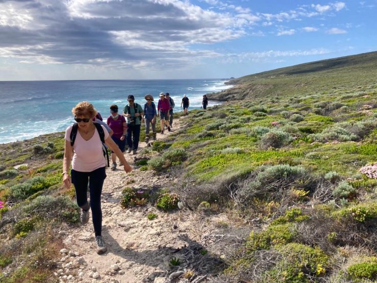
For those joining a guided Cape Walk, the experience becomes more comfortable and accessible. You’ll only carry a day pack, and all the logistics—like meals, nights accommodation, and transfers—are organised for you. With professional guides leading the way and sharing insights into the local flora and fauna, each day’s walk is manageable, enjoyable, and full of memorable moments.
When is the best time to walk the Cape to Cape Track?
The best time to walk the Cape to Cape track is from March – May and September – November. These shoulder seasons offer mild temperatures, clear skies, and a more peaceful experience with fewer people on the trail.
Spring (September to November) is especially beautiful, showcasing an astounding variety of wildflowers, including seasonal spider-orchids, kangaroo paws, and even golden whistlers flitting through the coastal heathlands. It’s the ideal time for nature lovers, with the variety of flora including many rare native species making their appearance.
Autumn (March to May) delivers cooler walking conditions, with fewer crowds and spectacular coastal views. While March and November can be quite warm, you’re unlikely to encounter a full week of hot weather. Due to the open landscape—limited in tall trees and therefore shade—anything over 25°C can feel warm, and over 30°C starts to become quite uncomfortable.
Here is a link to the weather statistics for Cape Naturaliste which will show you the average rainfall and temperatures for the year.
From June to September, average rainfall increases significantly, which impacts river and creek crossings. Key locations like Wilyabrup, Boodjidup Brook, and the Margaret River mouth may be uncrossable during winter. Wilyabrup usually clears by September, but Margaret River mouth can remain impassable into October. Always check current trail conditions through the Dunsborough Visitor Centre, DBCA, or other reliable local sources before setting out.
Use weather tools or a navigation app to help monitor conditions and pack accordingly—spring may bring blooms, but it’s also the season to be prepared for quickly changing coastal weather.
The best direction to walk the Cape to Cape Track
We always recommend walking North to South, from Cape Naturaliste Lighthouse to Cape Leeuwin Lighthouse—and here’s why it’s the preferred route for fit walkers and first-timers alike.
Firstly, walking north to south means the sun is at your back instead of glaring in your eyes all day. While some suggest walking the other way to benefit from the south-westerly wind, this breeze is mainly strong in summer—when it’s actually not advisable to walk the track due to heat and bushfire risk.
Starting from Cape Naturaliste also makes logistical sense. If you’re coming from Perth CBD, it’s about 1.5 hours closer than Augusta, meaning you can hit the trail sooner without needing overnight accommodation first. Plus, you’ll start with more manageable distances and terrain, especially around Smiths Beach, Canal Rocks, and Cape Clairault, before gradually building up to more dramatic stretches like Cape Hamelin and Deepdene Beach.
Ending at the tallest lighthouse on mainland Australia—Cape Leeuwin Lighthouse—feels like a true finish line. From the top, enjoy panoramic views where the Southern and Indian Oceans meet. It’s a memorable close to a journey filled with clifftop views, pristine beaches, and ever-changing natural beauty.
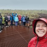
So whether you’re a solo hiker or joining one of our Cape Walk guided tours, north to south is the best way to fully experience the magic of the Cape to Cape Track.
Cape to Cape Track Walking distances… how to organise your walk
If you want go on a guided Cape to Cape Track walking tour, come with us! If you are planning on walking the Cape to Cape track independently, carrying a back pack and sleeping at the campgrounds. Our recommendation is to follow the proceeding itinerary.
Day One: Cape Naturaliste to Yallingup – 14km
Leave early from Perth, and drive to Cape Naturaliste. It is about a 3.5 hr drive. Leave your car in the carpark at Cape Naturaliste, and let the visitors centre (08 9755 3955) know when you will be back to collect it. Open this link to view the exact Cape Naturaliste lighthouse location to your phone (works on any device).
Walk 14km to Yallingup Caravan park. The walk should take you about 5 hours going at a reasonable pace with breaks.
There are not too many challenges with this first walk. The trail is easy to follow, and there are only two short beach stretches. The first 3km through to Sugar loaf rock are actually all paved, so really easy.
FYI – there are toilets at Cape Naturaliste, Sugar loaf rock, 3 Bears and at Mt Duckworth campsite. Toilets everywhere… Hurray!
You will need to pre book a camp site or cabin at the caravan park, so give them a call on (61) 8 9755 2164 and let them know Inspiration Outdoors sent you 🙂
It is possible to shorten this walk and stay for free at the Mt Duckworth campsite which is 11km from Cape Naturaliste, or about 45 mins prior to Yallingup. Mt Duckworth has a toilet and water tank and is nicely shaded under the Ti Trees. We do not recommend staying there, because it allows you to shorten the following day (which is pretty tough) and the mosquitoes are horrendous! That said, free is nice 🙂
Day Two: Yallingup to Moses Rock Campsite – 20km
A longer, more challenging day today. There is some soft beach sand to negotiate on Smith’s beach as well as Injidup beach. There is also a bit of a rocky stretch which can be challenging when you are carrying a big pack.
When you get to Injidup beach, there is a huge set of stairs that goes up to the car park, where there is a toilet. This is a good spot for a lunch stop and there is a little bit of shelter under the trees in the corner of the car park if it is hot or raining.
The afternoon is mostly on sandy four wheel drive tracks and is a bit boring until you get to Quinninup Falls, which runs between June-October. You will pass through Moses Rock car park where there is a toilet. At this point you are about 3km or 60 minutes from the Moses rock campsite. This section is awesome. Look out for Kangaroos through here. The campsite is free to use, so just turn up.
Day Three: Moses Rock Campsite to Ellensbrook – 18km
One of my favourite days on the whole track! This day has some beautiful coastal scenery as some great deep red rocks. The walking is easy and on a nice day, it is just magical.
The area around Wilyabrup is really stunning. There is a huge stainless steel staircase. When you get to the top of the stairs, the trail goes off to the left, however if you turn right you can get out onto the cliffs which are really worth the short diversion.
WARNING: Is Wilyabrup creek crossable? We have only ever had one occasion outside of winter when it hasn’t been crossable (it was September when we couldn’t get across) but it is worth checking particular if there has been a big down pour or there is a big swell. Check the dbca’s website for current conditions.
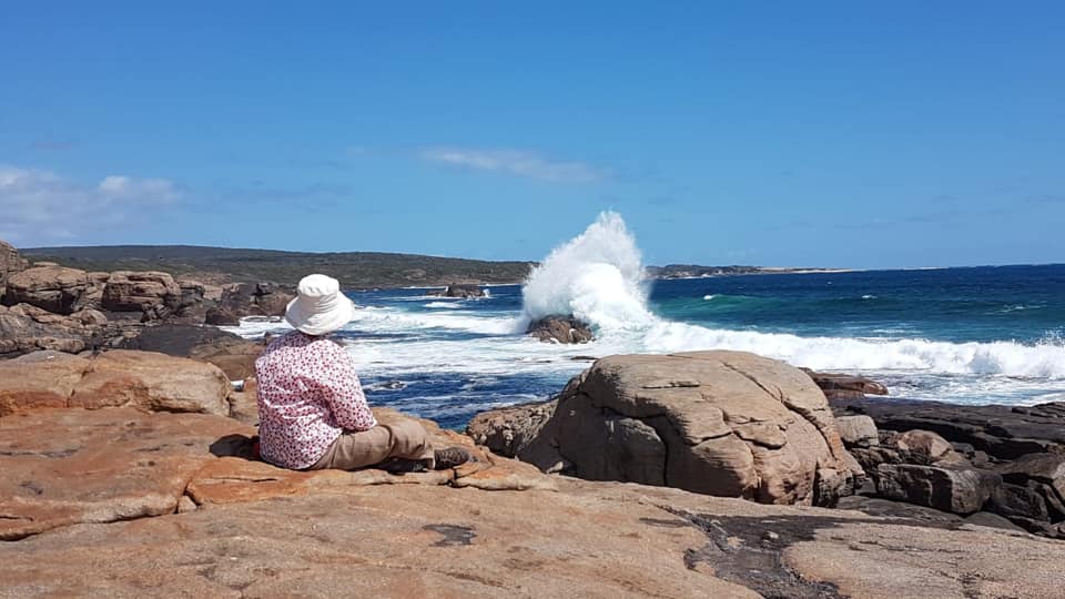
Just prior to Whaleback rock there is a great spot to stop for lunch. There isn’t much shelter on this day, but there is a little bit of a rock overhang where you can get some relief. If it is a nice day, this is a great spot to watch the waves crash in.
Take care when you get to Gracetown as there are lots of false paths. Officially the path goes along the beach, but it is soooo much easier to walk along the road to Huzzas. Stop in and get an ice cream from the Gracetown General Store too!
After Gracetown it is an easy and beautiful stretch on to the low key campsite at Ellensbrook where you will find a toilet and rain water tank. The campsite is about 10 minutes past the Ellensbrook Homestead so don’t camp there! The Ellensbrook campsite is free to use and you do not need to book.
Day Four: Ellensbrook to Prevelly (Margaret River Mouth) 14km
Much of the morning is inland away from the coast. The trail then pops out onto a wonderful stretch of beaches and is truly divine.
WARNING: Is The Margaret River crossable? The Margaret River is usually uncrossable from June to September. The DBCA monitor it closely so you can call them and ask at any time. If it is uncrossable you will also find a sign out on the track which will notify you of a diversion (which is boring and long, but better than being swept out to sea!)
You can camp or grab a campsite or cabin at the Prevelly caravan park or any number of other accommodation providers in Prevelly. This is also a great place to resupply as there is a small store/bottle shop.
Day Five: Prevelly to Point Road Campsite – 21km

A really special day. From Prevelly you head inland to Boojidup brook with it’s massive set of stairs (don’t worry, going down). From there it is out to the coast with a tough, soft beach stretch up to Redgate beach.
There is a toilet at the Redgate beach carpark, then it is back down on the sand for a short stretch.
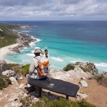
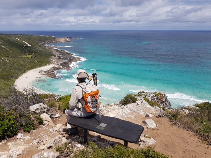
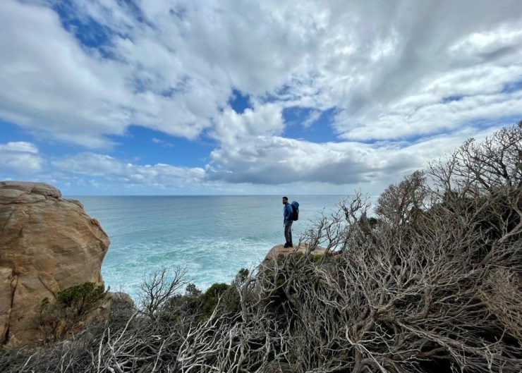
From the beach you then make your way slowly up to one of the most spectacular sections on the whole trail. There are some amazing cliff top vistas just prior to Contos campground.
You can either camp at Contos or Point Road which is another 20-30 minutes up the trail. Our recommendation is point road as it will be quieter and it shortens the distance for the next day. Both campgrounds have a cost to camp which is $22 for 2 people per night. These sites are best booked rather than just turning up, as they are very popular, but you should be okay if you are outside school holidays. You can book the Contos and Point Road sites at the Park Stay website.
Day Six: Point Road Campsite to Deep Dene Beach – 21km
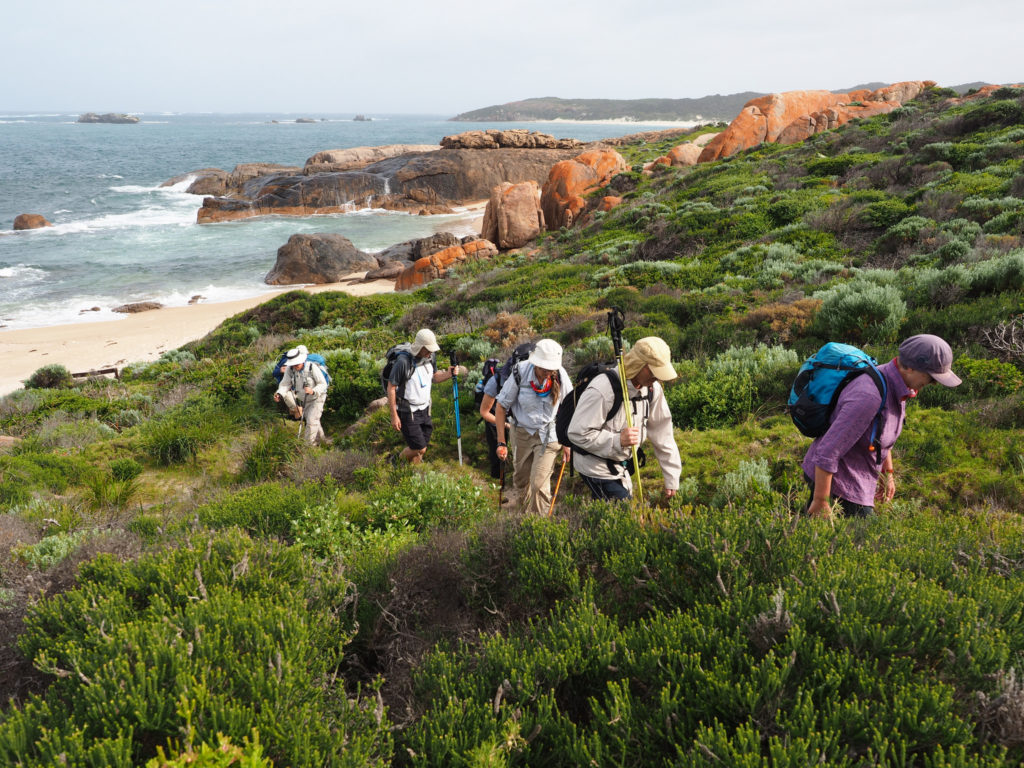
This day is tough. You start in the forest, which is just beautiful and quite easy. Then you make quite a sudden but thankfully short climb out of a valley and head towards the coast where you eventually meet Hamelin Beach. From there it is a 6km beach stretch to Hamelin Bay. This can be really hard when there is a head wind or the beach is soft. Try to find some tyre tracks to walk in, or take you boots off and walk next to the crashing waves where it is usually firmer.
If you are feeling like stretching it out, you can stay at Hamelin Bay ($$$) or just grab an ice cream and continue on.
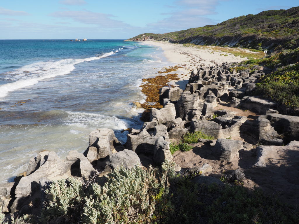
After Hamelin Bay there is a short but challenging stretch with some short sharp hills. Soon enough you will reach the Foul Bay light house, and then it is an easy walk to Cosy Corner rd. From Cosy Corner Road it is an easy walk along an interesting limestone shelf that is full of blow holes.
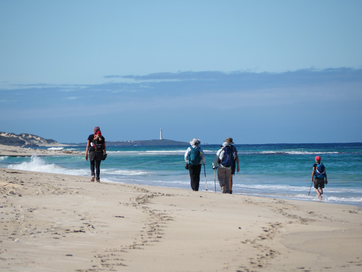
Then you round the Cape and on a clear day will get your first glimpse of Cape Leeuwin lighthouse! The end point of the trail.
The Deepdene campground is about 20 minutes up the beach in a sand dune blow out. Look out for it! You will see a gap in the dunes and then walk up the track for a few minutes. This is another low key campsite and you do not need to book it.
Day Seven: Deepdene to Cape Leeuwin – 18km
Last day! And another challenge. This is a big day with some more beach stretches. There is also some limestone ledges which you will need to negotiate.
The beautiful thing about today, is that you can see the Lighthouse almost all day. It starts off tiny and gets bigger and bigger as the day goes on… sometimes not quick enough!
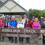
The official end of the Cape to Cape track is the Water Wheel just prior to the Lighthouse, but everyone goes to the Lighthouse and they will let you in for free (especially once they smell you!).
From the light house you can either hitch hike into Augusta or grab a taxi. The light house will call one for you, but if this is your plan, make sure you are there by 5pm otherwise it will be closed!
There are quite a few accommodation options in Augusta. My recommendation is to stay at the Augusta Motel where you can anything from backpackers room to something more fancy.
Day Eight: Return to Cape Naturaliste then drive back to Perth (or where ever).
There are buses from Augusta back up to Dunsborough with TransWA.
The buses depart Augusta at;
Mon/Wed/Fri at 8:00am
Tues/Thurs/ Sun at 8:10am
Sun at 3:05pm
Mon/Tues/Wed/Thurs/Fri at 3:05pm.
The bus takes about 1.5hrs to get to Dunsborough. From Dunsborough, you will need to take a taxi up to Cape Naturaliste to collect your car.
Accommodation and Logistics
If you choose a guided Cape to Cape Walking Tour, everything is arranged for you—from accommodation to accommodation.
Accommodation may include:
- Margaret River Motel
- Pullman Bunker Bay Resort
- Injidup Spa
- Karriview Margaret River
- Bunker Bay and other scenic locations
Some providers offer inclusive packs with transfers, food, gear hire, and an info pack with maps & info for each day of walking.
All transport logistics—like the minute transfer from East Perth to the start point—are handled with worry-free navigation.
Solo travellers can book a single supplement, while friends can share a twin share room.
What to Pack
A navigation app like Avenza or AllTrails is handy for off-track detours. Here’s what else we recommend:
- Day pack (if guided)
- Sunscreen and insect repellent
- Hat, swimmers and towel
- Reusable water bottles
- Walking poles (optional)
- Trail snacks and fresh fruit
If you’re self-guiding, plan your meals or rely on stops like Caves House and Goon Tycoons for a modern twist on local eats.
Wildlife, Culture and History
This stretch of WA is rich with Noongar heritage and stories. Many landmarks carry spiritual meaning and cultural significance.
You’ll see kangaroos, wallabies, possums, and an astounding variety of birdlife, including black cockatoos and golden whistlers. Some areas still reflect traces of European settlers, with stories shared by the Friends of the Cape.
Why Choose a Guided Tour?
We believe walking should be about the experience, not worrying about logistics.
Our guided Cape to Cape experiences include:
- Comfortable coastal accommodation
- Hand-picked local meals from a house catering company
- Transport and private transfers
- Support from friendly staff and knowledgeable guides
- No need to repack—just walk and unwind
You’ll explore all the major sites plus lesser-known gems like Cape Clairault, Jane Scott Cave, Honeycombs Beach, and the Walker Points.
And yes, there’s always a hot shower waiting at day’s end.
Ready to tackle the Cape to Cape Track but unsure about going it alone?
Why not join our 8-day Guided Tour? It’s designed for those with a moderate level of fitness – you don’t need to be an elite athlete to enjoy this adventure. You’ll carry just a daypack, and we’ll break the track into manageable stages. Yes, there are challenging beach sections, but our knowledgeable guides are there to assist and offer insider tips.
Aside from the spectacular views, one of the best parts of our guided tour is the excellent food and comfy accommodations we provide. This is an active holiday, but it doesn’t mean you can’t indulge a little! You’ll return each day to a delicious meal and a cozy bed – it’s the perfect balance of challenge and comfort.
So why wait? Embrace the adventure, create unforgettable memories, and experience the Cape to Cape Track the way it should be. Secure your spot on our 8-day Guided Cape to Cape Walking Tour now!
Useful Info Before You Go
- Be mindful of cancellation fees
- Pack for all weather—WA changes quickly
- Chat with the Dunsborough Visitor Centre and Bus Bay team if you need help
- Stay updated through INCENTIVE PROGRAM emails or the park alerts
- Respect country and wildlife along the way
Things to be wary of while walking the Cape to Cape track
River Crossings, you might come across on the Cape to Cape
The river crossings can be treacherous and it is important to have up to date information when walking between May and September. Please call the DBCA (08) 9219 9000) or check their website to get the most up-to-date information.
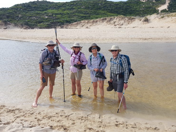
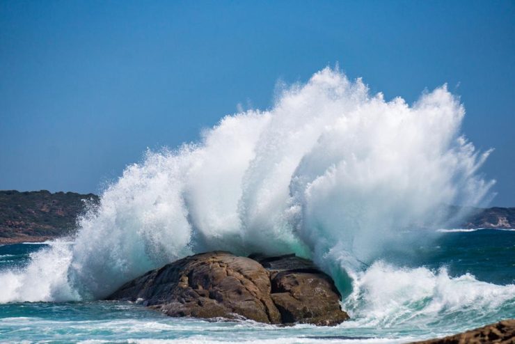
If you do choose to do a river crossing while carrying a heavy pack, always unclip your pack, keep an eye out for incoming waves and never dawdle on the other side. Unexpected king waves are common in the area.
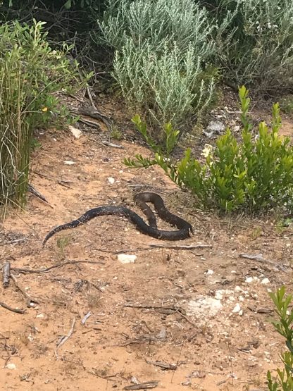
Snakes along the Cape to Cape Track
Snakes are not actually much of an issue unless you try to pick them up. Most of the time we just see a tail disappearing into the bush, as the snakes are definitely scared of humans. The chances of being bitten are so small, that with just a little bit of knowledge, you will be fine.
Bushfires threats on the Cape to Cape track
A good reason not to go hiking in summer! Bush fires are unpredictable and can be deadly. Thankfully they are rare, and they rarely kill people on the coast as they are easier to escape with the low vegetation and frequent vehicle access. Hiking in summer is not advisable but if you are going to do it, please read this blog post for some tips about how to hike safely.
Heat exhaustion / Dehydration walking in WA
There are water tanks at all of the camp grounds, so theoretically you should be okay. The water is untreated, though, so you will need some sort of water purification system. Our favourite is good old fashion condi’s crystals.
I’ve guided walking tours all across Western Australia, from the red gorges of Karijini to the white sands of Cape Le Grand. With years of experience in the field, I love helping travellers discover WA’s remote beauty on foot — one step at a time.