Great Smartphone Apps to Track Your Hikes
Great Smartphone Apps to Track Your Hikes
Posted on
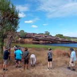
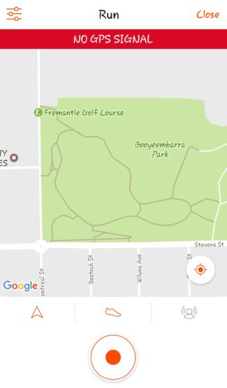
Escaping the urban lifestyle and getting lost for a few hours is one of the many advantages of hiking but what happens when you want to know where you got lost, for how long, how high you climbed and how fast you were going? With the widespread introduction of smart phones almost a decade ago, we have been able to take technology with us into the wild like never before. A raft of free tracking apps are now in the Apple/Google Play stores and all offer a slightly different user experience. Apart from satisfying the inner stat nerd within you, GPS tracking apps play an important part in your safety out in the bush (although should never be relied upon as your sole navigation aid).
Here are some of the better GPS tracking apps that you can get for free right now. I have only reviewed apps that are available for both iOS/Android and relevant to users in Australia because I’m a good sport about these things.
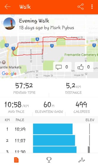
Runkeeper
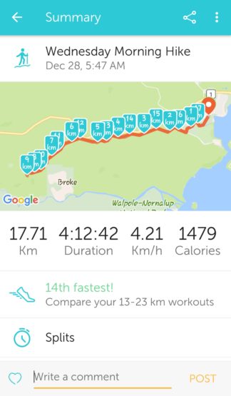
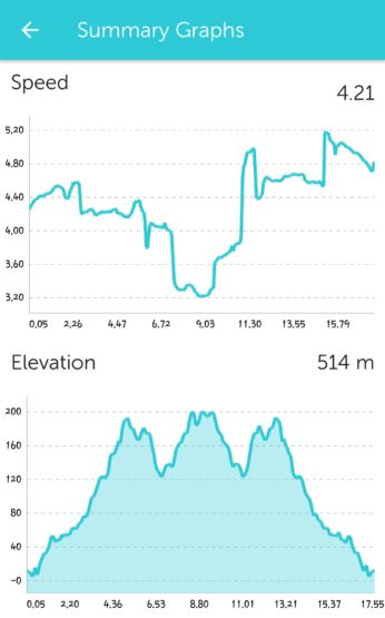
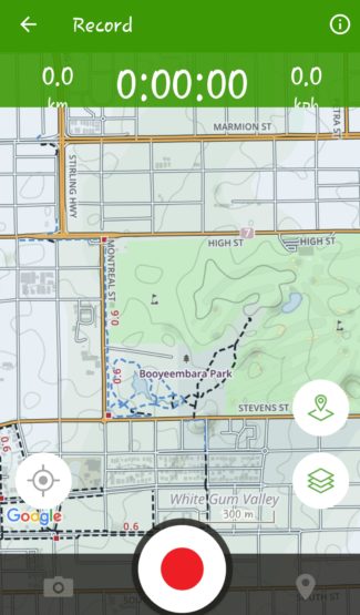
This app I have had the most experience of as I have used it to track all my hikes for the past few years. The user interface is pretty straight forward and quite pleasing to the eye. Live tracking of all your hikes is available but a data connection is required for the map to update itself. When you are finished it will give you all the information you require including distance, time, vertical climb, speed and elevation graphs and the option to add notes/friends you were with. It even has different voice prompts (Mr Announcer, Drill Instructor, Mademoiselle, Your Conscience & Boston Fan) if you enjoy knowing your splits/distance on a regular basis.
The app also comes with full website support so you can view all your hikes on a bigger screen and export the GPS data to a KML file or Google Earth. The team at Runkeeper also run challenges throughout the year that you can participate in for free to add extra motivation to get active. The biggest downside I have found is that sometimes the maps need a minor correction afterwards before they show the right data. Several times I have used it near the ocean and the elevation chart shows my activity as being -20m below sea level. The correction I make is to un-tick the “Snap to Roads” option in the Edit Activity feature on the website and adjust the final marker slightly. A small price to pay every now and then for a quality app.
Pros
– Easy to use/navigate
– Great looking user interface
– Loaded with features
– Well supported
Cons
– Maps sometimes need a basic edit to correct data
– Sliding between screens in Live Tracking can be difficult sometimes
Paid Version – Yes ($30USD/year). Upgrades include training plans, live broadcasting, insights, weather data and compare workouts.
Strava
When most people think of Strava they think of cycling and while that is their target audience, the app is certainly very useful for hikers. Being one of the more widely used apps on the market, the free features are abundant and the user interface is easy to navigate. Like Runkeeper, Strava is connected to a website where you can view all your completed activities, view your friendís activities and bask in all of the data/graphs that are available.
Unfortunately Strava is really setup for cyclists/runners so some of the really cool features don’t really apply. The ability to see your results in community created “segments” doesn’t show if you track your activity as a hike. While this would be fun to see, I think it goes against the ethos of hiking in that it doesn’t matter how long you take to do something, so long as you enjoyed the journey.
Strava is a perfectly fine way to track your hikes and the size of the overall online community is way above any other app.
Pros
– Easy to use
– Great online community
– Good looking online user interface
Cons
– Mainly for cyclists/runners
Paid Version – Yes ($90AUD/year). Upgrades include personalised coaching, live feedback and advanced analysis.
Map My Hike
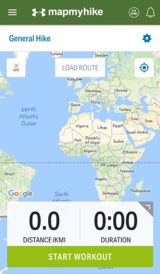
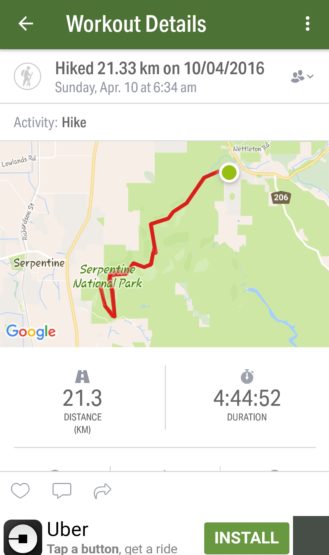
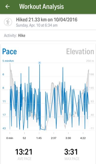
With the word “Hike” in the title things are promising for this app but unfortunately it’s just a branding exercise by MapMyFitness. That doesn’t mean that the app is useless, far from it. Along with MapMyRun, MapMyWalk etc, you will still be able track your activity, view it afterwards on their website and export GPS data. Being sponsored by Under Armour, you are privy to sponsored challenges every now and then.
Unfortunately Under Armour isn’t the only form of sponsorship you will be subjected to with plenty of Google ads appearing on the website. I also had issues with the GPS tracking not being terribly accurate. Apparently the majority of one of my afternoon walks was well below sea level despite being able to see the ocean occasionally. When elevation data is key to hikers, this was not a great experience and one that many have come across in my research. Unlike Runkeeper, I was unable to edit the activity to correct this.
Pros
– Easy to use
– Linked website with sponsored challenges
– Full lifestyle experience with connections to MyFitnessPal
Cons
– Questionable reliability of GPS tracking
– Too many ads
Paid Version – Yes ($30USD/year). Upgrades include training plans/analysis, live tracking and an ad free experience.
All Trails
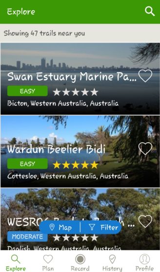
One of the worldwide leaders in crowd sourced trail information, All Trails provides a wealth of trail information available at your fingertips. As well as being able to track and view your hikes through the app, All Trails allows you to search and view an abundance of user created trails throughout the world. A quick search for Perth and a list of popular hiking and mountain bike trails comes up with information about length, elevation and location.
To be able to download and use the maps offline requires a pro membership but for the cost of a pub meal in WA, it is well worth it. If you have a favourite hike that you want to share with the world then why not save it for everyone to enjoy. Users can then log in and review the trail and leave comments on how they found it.
Pros
– Easy to use
– Great community with worldwide resources
– Existing trails are easy to find
Cons
– In-app ads
– Best features are only available in the Pro version
Paid Version – Yes ($30AUD/year) – Upgrades includes download/print existing trails, follow existing trails offline, create custom maps and an ad free experience.
Happy App’in
-Mark Pybus
Guest blogger