The Complete Guide to the Tarkine: Tasmania’s Wild Northwest
Posted on
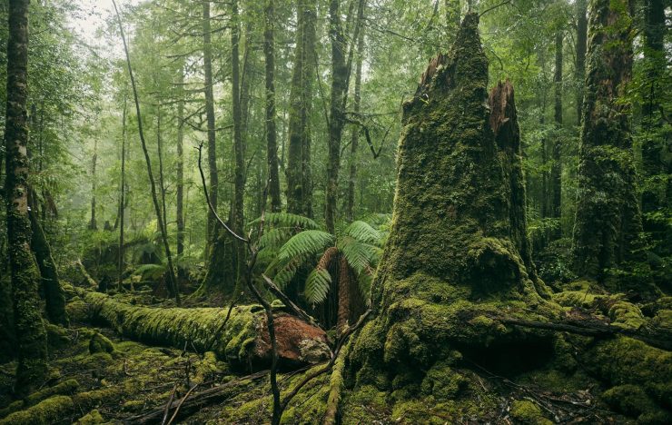
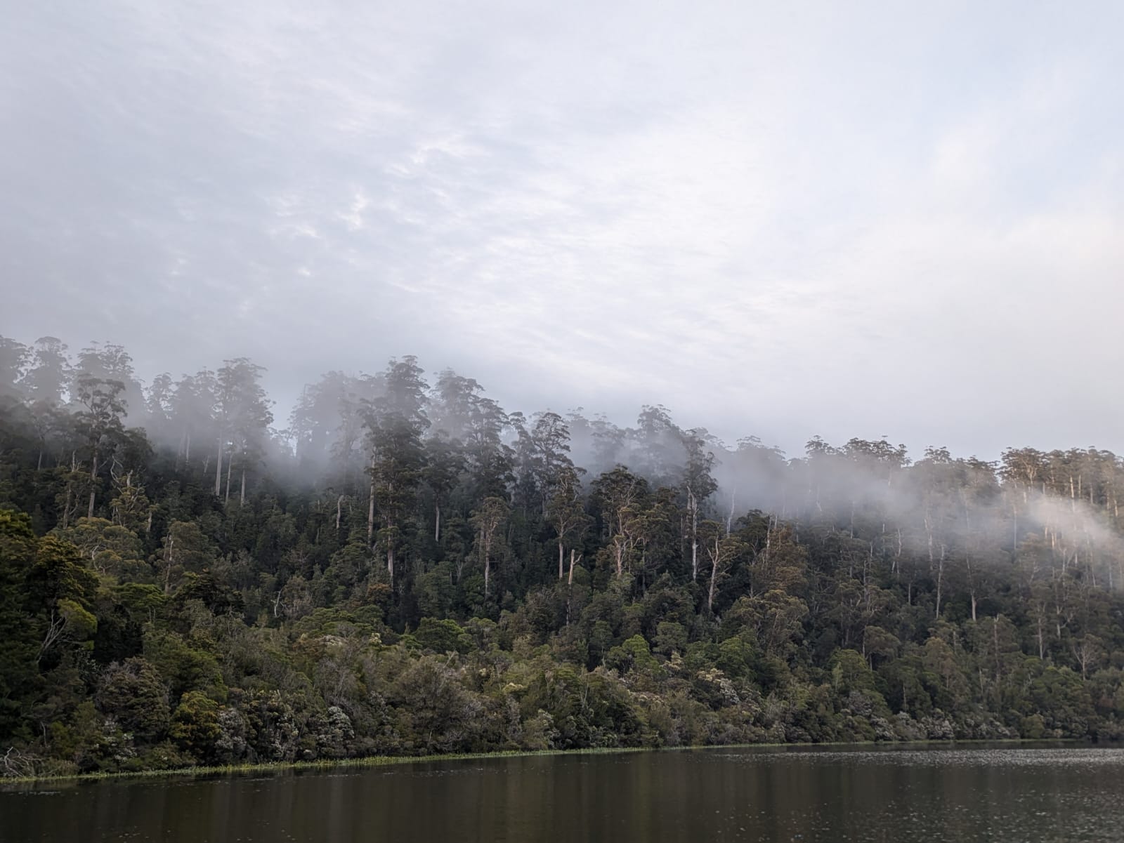
In Tasmania’s far northwest, the Tarkine – or takayna – feels like the edge of the world.
A vast, ancient landscape of Myrtle Beech, Huon Pine, and wild rivers, this is one of the last great temperate rain forests on Earth.
For travellers who love the idea of getting lost in a rainforest wilderness, the Tarkine is your invitation to step into another, possibly pre-historic world.
Tarkine Wilderness Boundaries and Landscape
Bounded by the Arthur River to the north and the Pieman River to the south, the Tarkine sprawls across 450,000 hectares of deep forest, rugged coastline, and button grass plains.
The Tarkine is part of the UNESCO Tasmanian Wilderness World Heritage Area. It has ancient Huon Pine and tall Myrtle trees. It is home to unique wildlife like Tasmanian Devils and Eastern Bettong.
Why the Tarkine Belongs on Your List
The Tarkine stands apart from other Tasmanian destinations; here’s why it deserves a place on your itinerary:
- It’s one of the world’s last temperate rainforests. According to state tourism the Tarkine protects over 400,000 hectares of intact forest, making it one of the largest tracts of cool-climate rainforest left on Earth. Walking here means seeing Gondwanan plant species that have existed for 60 million years.
- It’s rich in wildlife. You can spot the endangered Tasmanian Devil, Eastern Bettong, Tasmanian Native Hen, and wedge-tailed eagles – often without the crowds found in larger Tasmanian parks.
- The walking is accessible but immersive. Trails like Philosopher Falls, Savage River, and Lake Chisholm offer half-day hikes on well-formed tracks, while the Tarkine Coast Track and Mount Donaldson walks provide longer challenges for those wanting more adventure.
- It’s a living cultural landscape. The Tarkine contains hundreds of Aboriginal heritage sites, including middens and rock carvings. A guided tour and local stories deepen the experience.
- It combines wilderness with comfort. You don’t need to rough it to explore this region. Eco-accommodation like Corinna Wilderness Lodge and Corinna Wilderness Village offer warm showers, great food, and a warm bed for those who don’t want to be pitching up tents.
- It’s easy to reach, but feels remote. The Tarkine is just a few hours’ drive from Launceston or Devonport, yet once you’re here, it feels like you’ve gone remote.
Walks Worth Wandering
You now understand why the Tarkine is special. You are probably eager to put on your boots. You want to find out which walks you can do. Here are some of our favorite walks. Maybe they will become your favorites too.
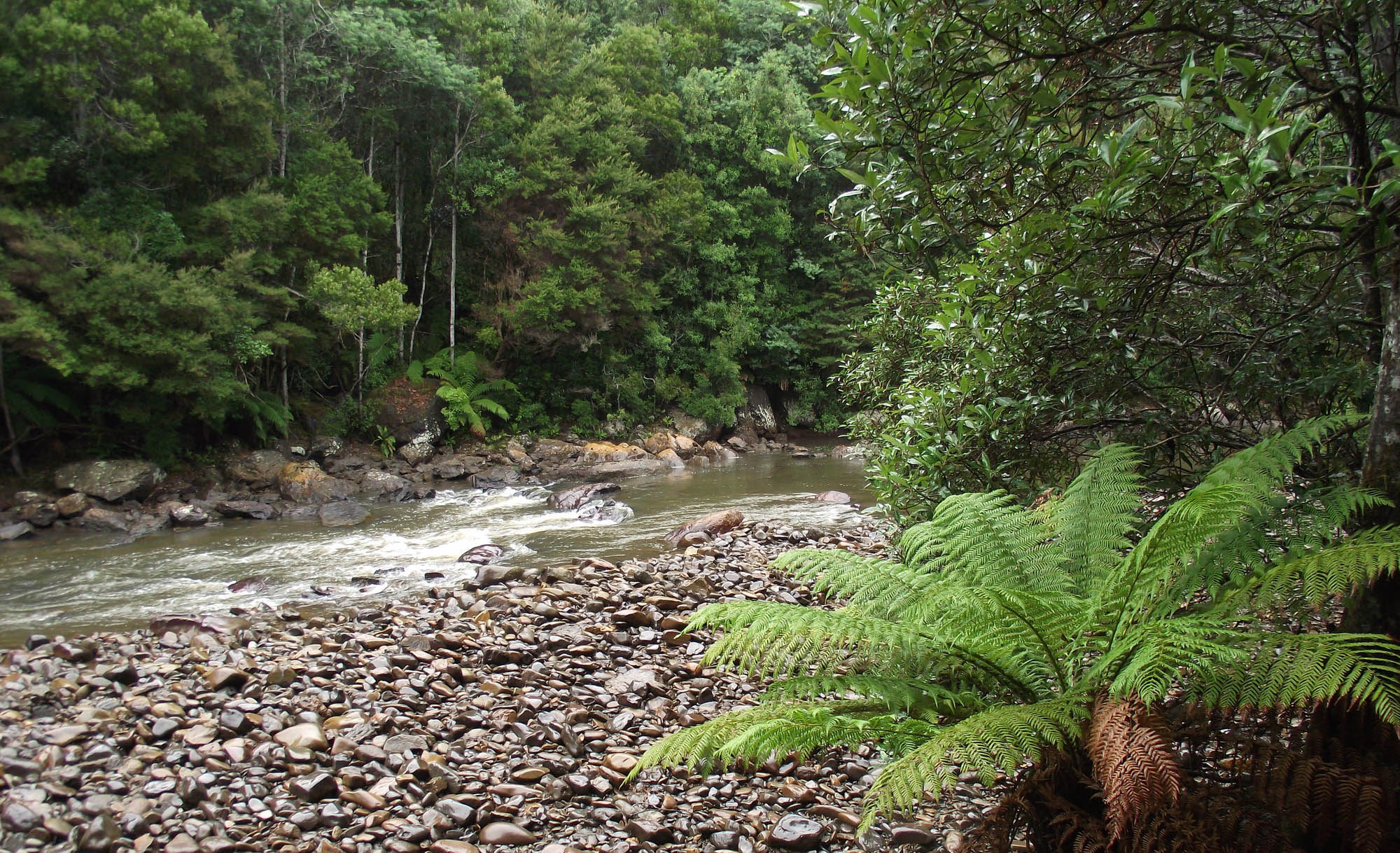
Savage River Walk
This short loop walk is a great way to stretch your legs and get a real feel for the Tarkine rainforest. The Savage River Walk is around 1.5 km and takes about 45 minutes return on an easy, well-formed track.
Starting near the Savage River Picnic Area, the trail follows the edge of the Savage River through a cool, shady forest of Myrtle Beech, Sassafras, and tree ferns. It’s mostly flat with a few short steps and boardwalks, making it suitable for most walkers.
You’ll see thick moss on fallen logs, bright green ferns at every turn, and the dark, tannin-stained water that gives the river its name. If you’re quiet, you might spot a Tasmanian Native Hen or hear the calls of other local birdlife.
Tips for the walk:
- The track can be slippery after rain – wear shoes with a good grip.
- Early morning or late afternoon are great times to walk for softer light and fewer people.
- Bring your camera; the reflections in the river are worth a few photos.
- If you have time, combine it with the nearby Huon Pine Walk for another easy, beautiful trail close to Corinna Wilderness Lodge.
It’s a simple, satisfying walk that shows off what the Tarkine does best — quiet forest, clean air, and the kind of peace that’s hard to find elsewhere. Check out more information about the Savage River National Park at Tasmania.com.
Julius River Reserve Walk
Julius River Reserve Walk is one of the easiest ways to experience the Tarkine’s lush rainforest up close. It’s a well-maintained loop of around 1.5 km, taking about 45 minutes at a relaxed pace.
The trail starts from the Julius River picnic area, which has:
- Toilets
- Picnic shelters
- and plenty of parking
From there, you’ll walk beneath tall Myrtle Beech, Leatherwood, and Sassafras trees, with interpretive signs along the way explaining the local plants, Huon Pine, and the area’s rainforest ecology.
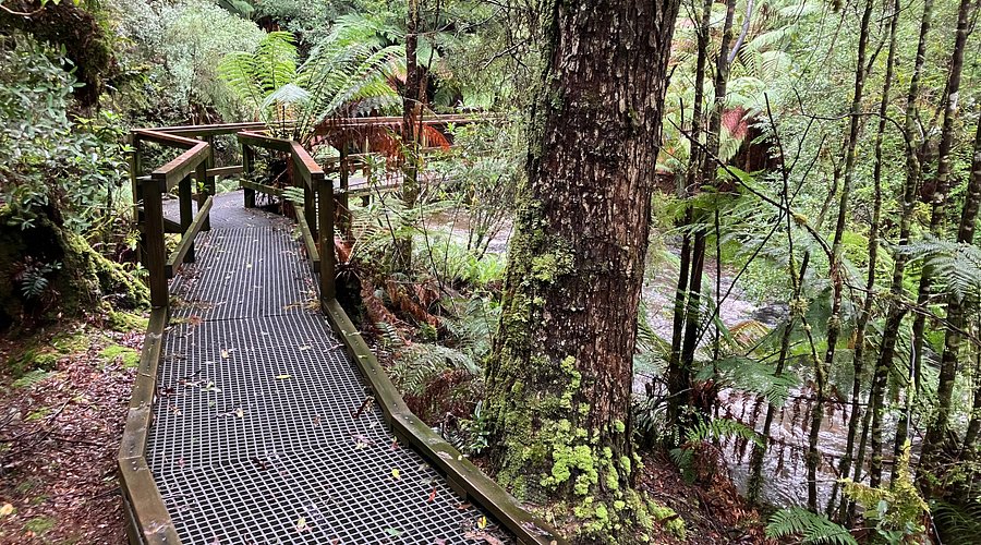
Expect plenty of moss, ferns, and the sound of the Julius River nearby. The track is mostly flat with a few short steps and bridges, so it’s a good option for anyone wanting a gentle walk without missing out on the full rainforest feel.
Tips for the walk:
- Bring a light jacket — it stays cool and damp under the canopy, even on warm days.
- Stop at the picnic area for morning tea or lunch; it’s one of the prettiest rest spots in the region.
- If you’re driving the Tarkine Loop Road, this is an easy and worthwhile stop between Milkshake Hills and Lake Chisholm.
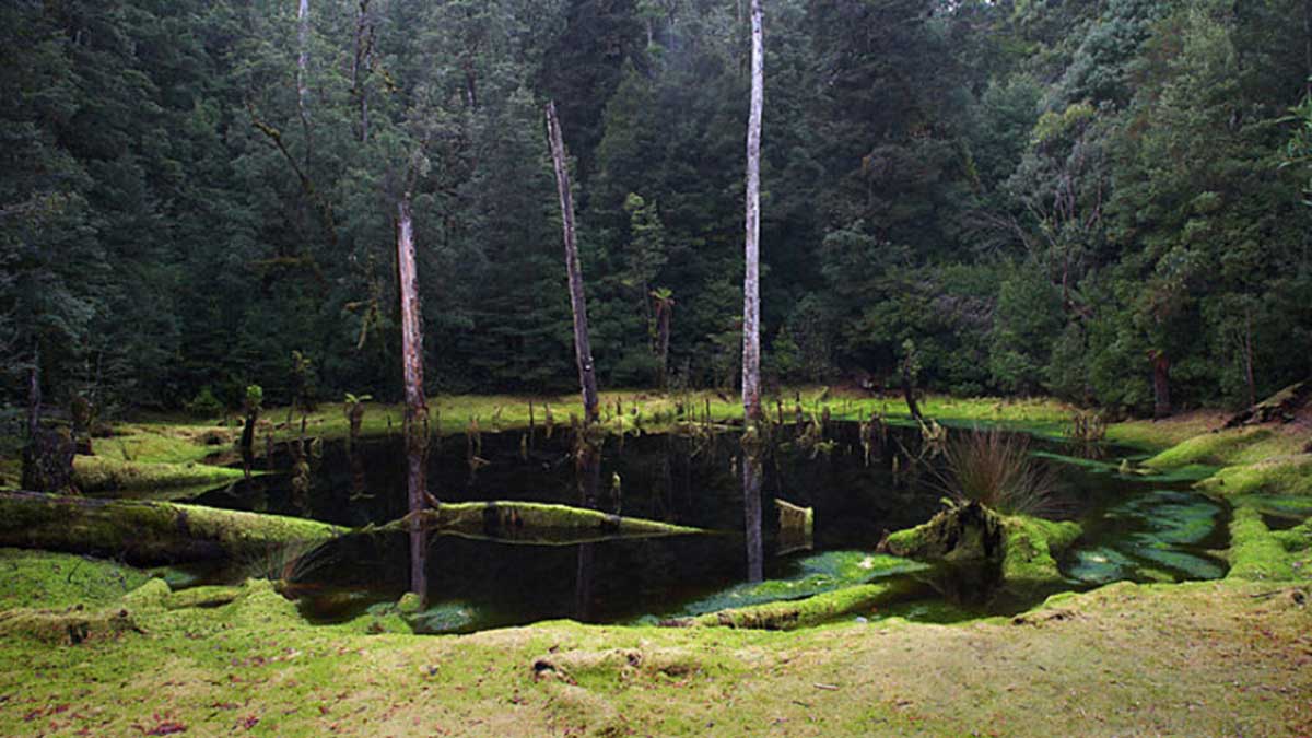
Lake Chisholm Sinkhole
The Lake Chisholm Sinkhole Walk is one of the Tarkine’s most popular short walks – and for good reason. It’s about 2 km return and takes roughly 45 minutes on an easy, well-marked track.
The trail begins from the Lake Chisholm car park, winding gently through cool Myrtle Beech and Blackwood forest before opening out onto a calm, mirror-like lake. The lake was formed, from Discover Tasmania, when an ancient cave system collapsed and filled with water, creating a sinkhole lake that perfectly reflects the surrounding trees.
It’s an easy walk suitable for most fitness levels, with a few gentle rises and steps but nothing steep. There are benches at the lake’s edge – a great spot to sit quietly and take in the view.
Tips for the walk:
- Go early or late in the day for the best reflections and fewer people.
- The track can be muddy after rain, so wear waterproof shoes.
- Bring a camera — this is one of the most photogenic spots in the Tarkine.
- Combine it with nearby walks like Julius River or Milkshake Hills for a relaxed half-day of exploring.
Philosopher Falls Rainforest Walk Details
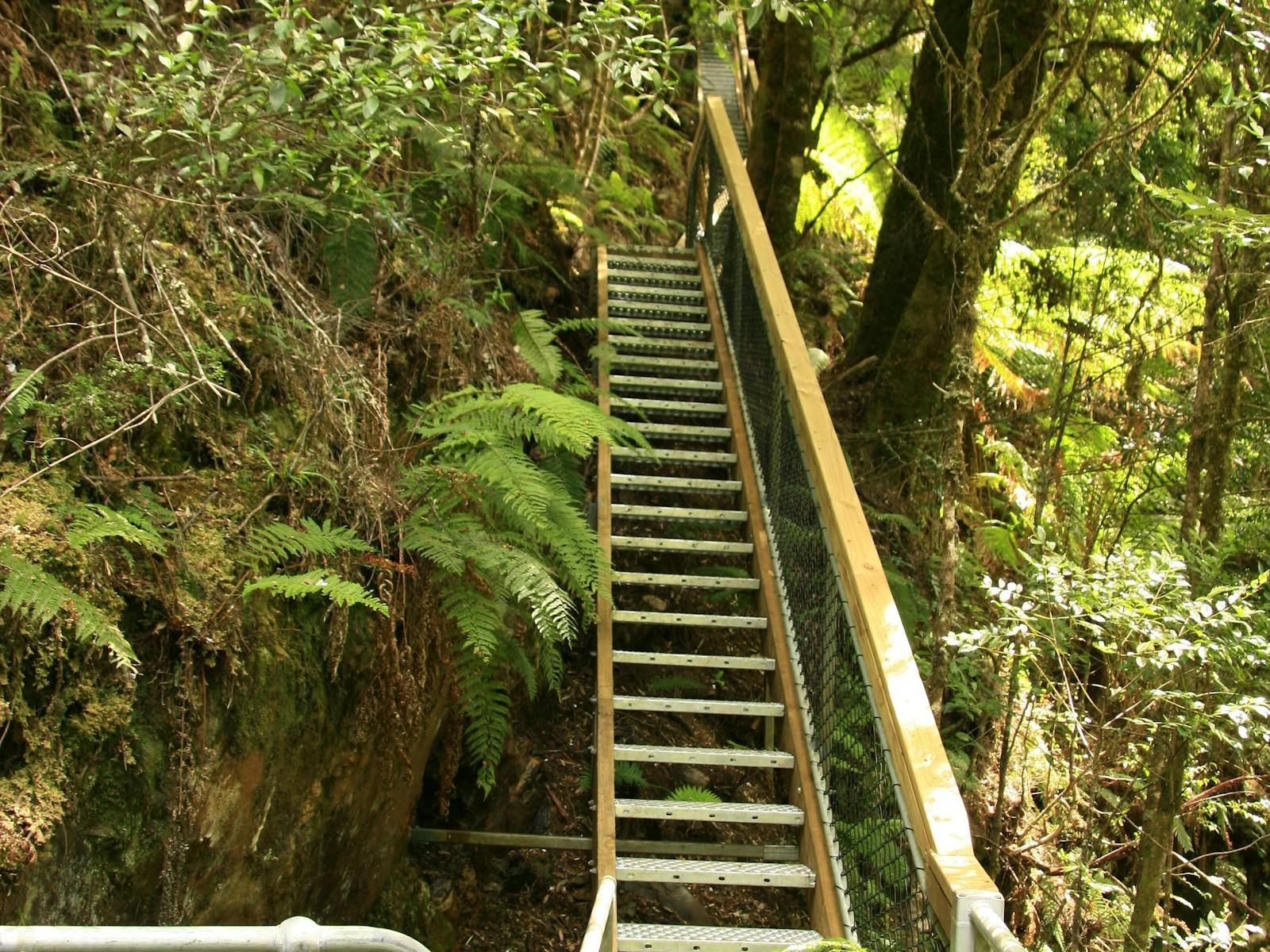
The Philosopher Falls Walk is one of the Tarkine’s must-do rainforest walks – a little longer than the others, but absolutely worth it. Located near Waratah, the track is around 3 km return and takes about 1 to 1.5 hours at a steady pace.
The trail starts from the car park just outside town and follows an old miners’ track deep into the forest. You’ll walk beneath tall Myrtle Beech and Leatherwood trees, with plenty of moss and fungi adding colour along the way. The path is mostly well formed, with a gentle gradient for most of the walk until the final stretch — a steep stairway that leads down to a viewing platform overlooking the impressive Philosopher Falls.
The falls tumble through a lush gorge and are especially beautiful after rain, when the water is at full flow and the mist hangs low through the trees.
Tips for the walk:
- Allow a bit more time than you think; the forest sections are so peaceful you’ll want to linger.
- The steps down to the viewing platform can be slippery — take your time, especially on the way back up.
- Bring a light rain jacket and insect repellent — this is true rainforest walking.
- Stop in Waratah afterwards for coffee or lunch; it’s a friendly little town with an interesting mining history.
Mount Donaldson Summit Walk
The Mount Donaldson Summit Walk (according to Alltrails) is one of the best ways to take in the Tarkine’s wide-open landscapes. It’s a solid half-day hike at around 7 km return, usually taking 3 to 4 hours depending on your pace.
The trailhead is about 15 minutes’ drive from Corinna, off the Savage River Road. The track begins in low button grass plains before gradually climbing through open forest and up towards the summit. It’s a steady uphill walk rather than a scramble, with a few steeper sections near the top.
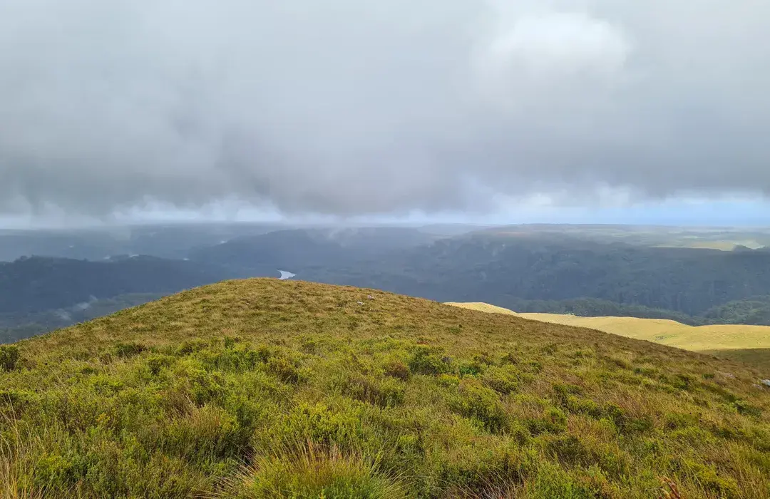
From the summit, you’ll be rewarded with sweeping views across the Savage River valley, the Tarkine Loop Road, and on a clear day, all the way to the Pieman River and the west coast. The landscape feels vast and untouched — a real contrast to the dense rainforest you’ll find on other Tarkine walks.
Tips for the walk:
- Start early to catch the morning light and avoid walking in the heat of the day.
- The track is exposed near the top, so pack a hat, sunscreen, and plenty of water.
- It can be windy on the summit — bring a light jacket, even in summer.
- The return trip is all downhill, but still uneven underfoot — trekking poles can help.
- Combine it with a night at Corinna Wilderness Lodge for an easy base and a good meal after your climb.
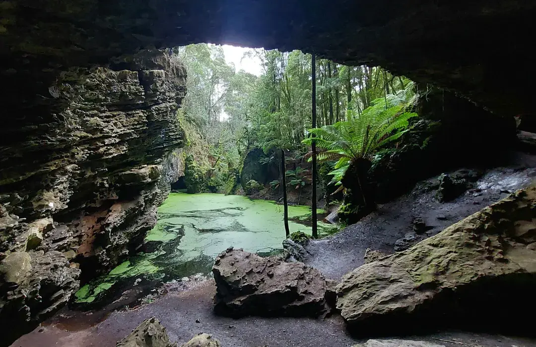
Trowutta Arch Walk and Photo Spot
The Trowutta Arch Walk is one of the most photographed spots in north-west Tasmania — and once you’re there, it’s easy to see why. The trail is short, about 1 km return, and takes around 20–30 minutes at an easy pace.
Starting from the Trowutta Arch car park, the track gently descends through lush Myrtle Beech and Tree Fern forest before reaching the arch itself — a natural formation created by a collapsed magnesite karst system. The arch frames a striking, jade-green sinkhole pool that stays perfectly still even on windy days.
The walk is short, but it’s worth taking your time. The forest is dense and peaceful, and the light filtering through the canopy gives the whole place a calm, otherworldly feel.
Tips for the walk:
- The track can get muddy after rain — waterproof shoes are a good idea.
- Early morning or late afternoon are great for photos when the light hits the water just right.
- There’s limited phone reception, so download maps before you go.
- Combine it with nearby stops like Lake Chisholm or Milkshake Hills for an easy day of short walks and rainforest exploring.
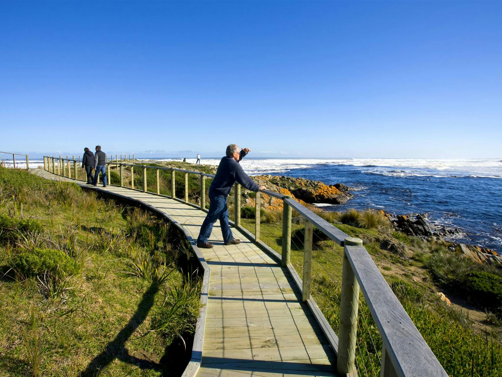
The Tarkine Coast Track
If you’re looking for something a little wilder, the Tarkine Coast Track delivers the full west coast experience – big skies, empty beaches, and that feeling of being right on the edge of things.
The route runs between Pieman Heads and Sandy Cape, covering roughly 60 km over 4 to 5 days. It’s an unmarked wilderness walk that follows long stretches of sand, coastal heath, and rocky headland crossings. You’ll encounter soft dunes, small river crossings, and occasional sections where you’ll need to pick your way over rock shelves.
There are no facilities along the way, so this one’s best suited to experienced walkers who are self-sufficient and confident with navigation. The rewards are huge though — solitude, ocean views, and that unmistakable sense of remoteness the Tarkine is known for.
Highlights along the way:
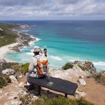
- Edge of the World Lookout (Arthur River): sweeping views of the roaring Southern Ocean — the perfect place to start or finish your journey.
- Pieman River Heads: a quiet, beautiful spot where the river meets the sea; arrange a boat transfer from Corinna Wilderness Lodge to access the trailhead.
- Endless stretches of beach walking, with wildlife sightings including wallabies, shorebirds, and sometimes seals.
Tips for the walk:
- Check tides before setting out — some headlands can only be crossed at low tide.
- Carry an emergency beacon; phone reception is limited.
- Be prepared for strong winds, soft sand, and rapidly changing weather.
- If you’d rather not go fully independent, local operators occasionally offer supported or guided walks along sections of the track.
Walking on Sacred Ground
The Tarkine — or takayna — has been home to Tasmanian Aboriginal people for more than 40,000 years.
Along the coast and rivers, traces of that long connection remain in the form of shell middens (learn more about these on the Aboriginal Heritage website here), stone tools, and rock shelters, particularly around Arthur River, Sandy Cape, and the Pieman River. The name “Tarkine” itself comes from the Tarkiner people, whose country stretched across this north-west corner of Tasmania.

Tasmanian Aboriginal communities keep their connection to takayna strong. They protect the Tarkine as a living cultural landscape. Walking here means more than exploring a wilderness. It is an opportunity to move through a place shaped by tens of thousands of years of culture, knowledge, and care.
Practical Tips for Exploring the Tarkine
Tarkine Temperate Rainforest Weather Conditions
The Tarkine has a temperate rainforest climate, which means mild temperatures, regular rainfall, and conditions that can shift quickly – sometimes all in a single day.
- Summer (Dec–Feb): Mild and pleasant, with daytime highs around 20–25°C. It’s the driest time of year but still expect occasional showers.
- Autumn (Mar–May): Cool, calm, and green. Great walking weather with fewer visitors and crisp mornings.
- Winter (Jun–Aug): Wet, misty, and often under 10°C. Rivers run high and the rainforest is at its most atmospheric — pack solid waterproofs and warm layers.
- Spring (Sep–Nov): Lush and full of life, with wildflowers and fungi in bloom. Conditions vary — you’ll likely see both sunshine and showers.

No matter when you visit, pack a waterproof jacket, sturdy boots, and a sense of humour — the Tarkine’s weather is part of what keeps it so beautifully wild.
Getting Around
Western Explorer Road (C249)
The Western Explorer Road (C249) links Arthur River in the north with Corinna in the south, running for about 120 km through the heart of the Tarkine. It’s a well-graded gravel road known for its sweeping views of button grass plains, rolling hills, and dense forest.
Allow 3 to 4 hours for the full drive, depending on stops — it’s not a road to rush. There are no fuel stations or shops along the way, so fill up before leaving Smithton, Waratah, or Zeehan. Mobile coverage is patchy, but the sense of remoteness is part of the appeal.
As you travel this route, you’ll encounter access points leading to several inviting short walks and breathtaking lookouts. Notable spots include Milkshake Hills, Julius River, and Lake Chisholm, each offering unique experiences of the Tarkine. The road is usually suitable for most vehicles in dry weather. If the area has had heavy rainfall, it is better to use a 4WD. The road conditions can become more difficult then.
Preparing for Easy to Moderate Trails
Most trails are easy to moderate. A solid level of comfort on uneven terrain is all you’ll need.
Read our guide on prepping for a walking holiday here.
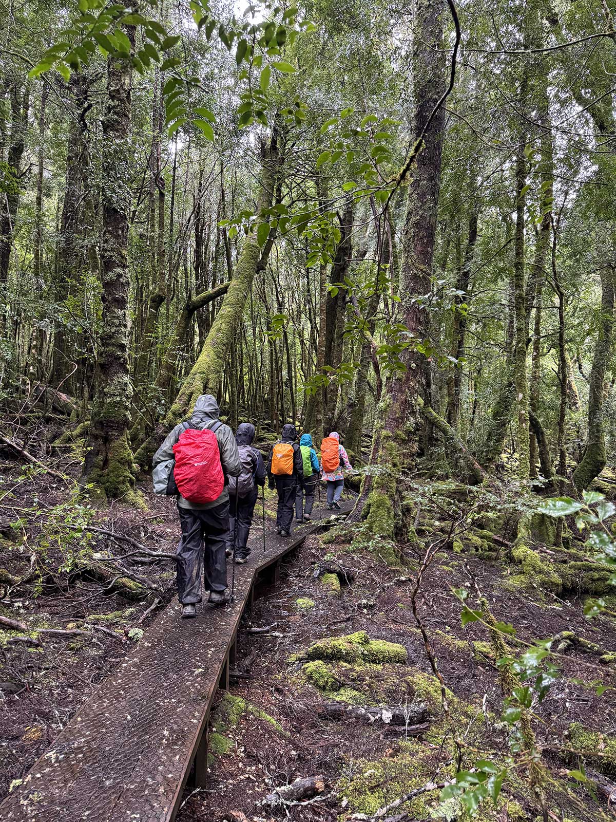
Essential Hiking Gear and Safety Tips
The Tarkine is wild and remote, which is a big part of its appeal — but it also means being prepared matters. Weather can change quickly, tracks can be slippery after rain, and mobile reception is limited in many areas.
Here’s what to pack and keep in mind before setting off:
Clothing & Footwear
- Sturdy hiking boots or trail shoes with good grip — many tracks are muddy or uneven.
- Waterproof jacket and pants — rain is common, even in summer.
- Lightweight, moisture-wicking layers so you can adjust to changing temperatures.
- A warm fleece or jacket, especially in the cooler months or for early morning starts.
Daypack Essentials
- Water (at least 1–2 litres per person, more for longer walks).
- Snacks or lunch, as there are no food outlets once you’re out on the trails.
- Map, compass, or offline navigation app — phone coverage is patchy across the region.
- First-aid kit, including blister care and insect repellent.
- Sun protection — hat, sunscreen, sunglasses.
- Emergency beacon (PLB) if you’re going beyond short walks or travelling solo.
Safety Tips
- Always check track conditions before starting, especially after heavy rain.
- Tell someone your plans if heading off-grid — where you’re going and when you expect to return.
- Stay on marked tracks to avoid damaging fragile vegetation or disturbing Aboriginal heritage sites.
- Carry out all rubbish and leave no trace — the Tarkine is pristine and should stay that way.
- If in doubt, join a guided walk. Local guides bring knowledge, safety, and a deeper
Local Guided Tours by Tarkine Operators
Inspiration Outdoors offer guided experiences – ideal for those who want local stories and logistics handled with care.
Discover the Tarkine & Cradle Walking Tour
Join experienced local guides on your journey. Enjoy comfortable accommodations as you explore and immerse yourself in the untamed beauty of Tasmania’s wild northwest.
See the Tarkine & Cradle Walking Tour with Inspiration Outdoors
Beyond the Tarkine
Tasmania rewards those who wander widely.
If you have time, pair your Tarkine adventure with:
- Cradle Mountain–Lake St Clair National Park – alpine lakes, wombat-dotted plains, and walks to Dove Lake, Hanson’s Peak, and Marion’s Lookout.
- Walls of Jerusalem – a lesser-known alpine gem.
- Three Capes Track or Freycinet Peninsula – for coastal drama and blue horizons.
- Bonorong Wildlife Sanctuary – to meet the Tassie devil up close and learn about conservation in action.
Tarkine Walking Trail FAQs
Is the Tarkine suitable for most walkers?
Yes. The trails range from easy to moderate, with well-marked paths and several short walks perfect for half-day exploring. Guided tours are available if you prefer local knowledge and logistics handled for you.
Do I need a 4WD?
A standard vehicle is fine for most sealed and gravel roads, but a 4WD is recommended if you plan to drive the full Western Explorer Road (C249) or reach more remote coastal spots like Sandy Cape.
When’s the best time to visit?
Spring (Sep–Nov) and autumn (Mar–May) are ideal – mild weather, lush forest, and fewer visitors. Summer offers longer days and easier driving conditions, while winter brings misty, atmospheric walks for those who don’t mind the rain.
How long should I plan to stay in the Tarkine?
Allow at least two to three days to see key highlights like Philosopher Falls, Julius River, Lake Chisholm, and Arthur River. For a deeper experience, a five to seven-day trip lets you combine walks, scenic drives, and time to relax.
Where’s the best place to stay?
Corinna Wilderness Lodge is the standout choice for comfort in the heart of the Tarkine. You’ll also find accommodation in Waratah, Stanley, and Arthur River, each offering good access to nearby walks.
Are there facilities or cafes in the Tarkine?
Facilities are limited. You’ll find toilets and picnic areas at major walk trailheads like Julius River and Lake Chisholm, and a restaurant and small bar at Corinna Wilderness Lodge. It’s best to bring snacks, water, and fuel up before you arrive.
Is there mobile phone coverage available?
Coverage is patchy to non-existent in most of the Tarkine. Download offline maps before your trip and let someone know your plans if travelling independently.
Can I swim or kayak in the Tarkine?
Yes, in safe, calm areas like the Pieman River near Corinna. Kayak hire and cruises are available, but swimming in rivers should be done with caution due to cold water and limited access points.
What kind of wildlife might I see?
Keep an eye out for Tasmanian Devils, Bennett’s wallabies, pademelons, echidnas, and a variety of birdlife. Early mornings and dusk are the best times for spotting animals.
How can I explore respectfully?
Stick to marked trails, don’t disturb Aboriginal heritage sites or middens, and take all rubbish with you. Choosing operators who care about the environment helps protect the Tarkine’s environment. Choosing eco-conscious accommodation also helps protect it.
I’ve guided walking tours across Tasmania’s wildest trails and most remote coastlines, sharing my love for the island’s landscapes, wildlife and stories. There’s nothing I enjoy more than helping travellers experience Tassie on foot — one step at a time.